August 9, 2018: Day Two.
Ennerdale Bridge to Rosthwaite via the High Route.
Just over 15 miles with around 2900 feet of elevation gain.
The guidebook warns that this is one of the rainiest portions of the Coast to Coast, but we lucked out and had a bright, sunshiny day. So sunshiny, in fact, that all three of us ended up with major sunburns in spite of our sunblock.
This day was one of my favorites -- the high route reminded us of ridge walks in the White Mountains. If you do the Coast to Coast, definitely do the high route unless weather dictates otherwise. You've come all this way, so get your money's worth! The scenery is drop-dead gorgeous and rivals anything we've ever done (and we've done quite a lot).
A warning: The owner of the Shepherds Arms informed me that if a hiker does not show up by 7pm at their reserved B&B, then the owner often calls Search and Rescue. This is important if you're the kind of hiker that plans very long miles in a day and figures they can arrive at their destination in headlamps, no problem. Therefore, if you are planning a very long day (we had a 23-miler in our schedule), email and/or call your B&B the evening before or the morning of your reservation and let them know of your plans...otherwise, you might find you're the subject of a Search and Rescue when you absolutely did not need Search and Rescue!
After a hearty breakfast of eggs, sausage, beans, mushrooms, tomatoes, toast, and coffee (standard B&B fare, which is wonderful and glorious), we set off from the Shepherds Arms and headed toward Ennerdale Water, a giant lake with paths around both its southern and northern shores. The guidebook warns that the main route (the southern path) floods during periods of heavy rain, but we had no such issues on this dry and clear day.
The way to Ennerdale Water involves country roadwalking, with a few twists and turns. Pay attention to your guidebook and you'll be fine.


Heading along the southern path...


This bit is straightforward; follow the path along the lake. There is one rocky bit that involves minor scrambling -- it's called Robin Hood's Chair, and it looks like this...


Where Sage is standing (below) is the "chair" section, which is a part where one can sit and lean one's back against the upper bits (where Alex is descending above) and dangle one's legs down the lower bits (where Sage is about to descend below).

After that, it's more walking along the lake until you run out of lake, and then it's across a field...

...where you can turn around and look back at the lake...

...and then you take a left and walk between two stone walls, turn right, enter a forest and walk along a wide dirt road, and then....choose your path. You can continue along the forest road for miles until you finally start to go up just a bit above treeline, or you can choose the high route, which mimics our beloved White Mountains and rewards the hiker with ridge walks and gorgeous views (provided you have good weather). In horrible no-good very bad weather, stick to the forest road. Otherwise, up you should go.
The entrance to the high route off the forest track is a bit confusing. I don't have a photo of it, but remember it is after you pass YHA Ennerdale and immediately PAST the gate which is by a little building which is kind of hidden in the woods on the left. The current guidebook's map shows the path starting before that gate -- that is not correct, it is just AFTER the gate. So save yourself some wandering about in the woods looking for it...just go past the gate and you should see the trail on the left.
Pay attention to your guidebook on the way up, and look for the cairns. The first ascent, and the one which of course requires the greatest elevation gain, since you are ascending from the valley, is Red Pike.

Looking back while ascending...


Up up up...


View of Ennerdale Water behind us...you'll feel proud of yourself knowing you hiked the entire length of that earlier that morning...and at this point, you have only just begun your day's mileage.

Views views views!


We got to the top and sat for a few minutes before moving on to High Stile, the next (and higher) peak.


It's a short and moderate ridge walk to High Stile. The photo below makes it look like one has to walk a long way...it feels very short when you actually do it, though.

 |
| Looking back at the girls |
 |
| The last push |


 |
| Here come the girls |


After half an hour of happy lounging, we moved on toward High Crag, which was a peak lower down.


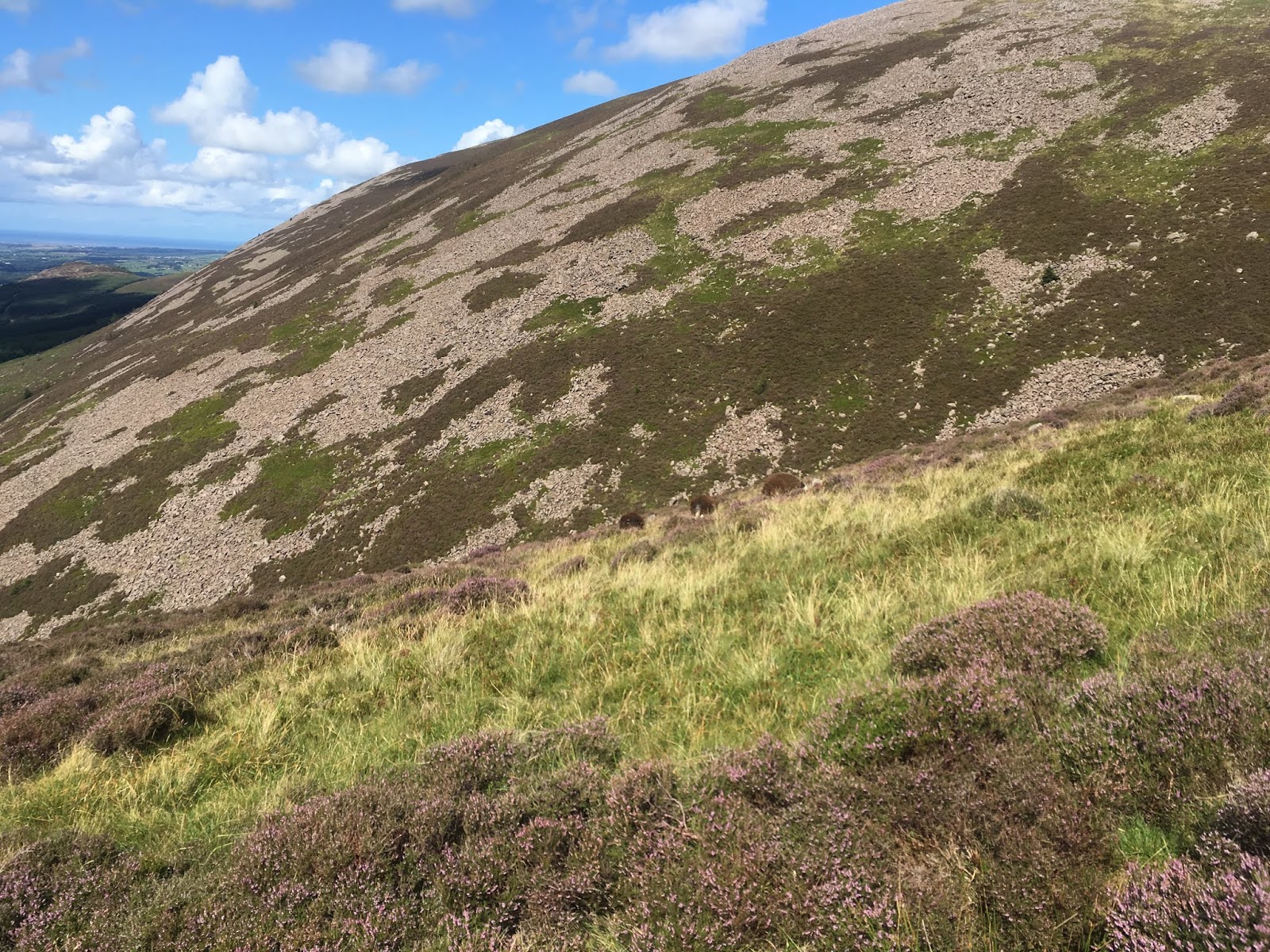
From here, it was a STEEP descent over loose gravel (not shown in the photo below, but just past the rocks and grass in the forefront). This descent would be extremely difficult in wet weather...might have to go down on your bottom and hope you don't slide out of control.

From the bottom of the col, it was up a bump, down a bump, and then up some steep scrambles to Haystacks.

Haystacks has a flattish top with a few minor scrambles. If you're from NH, then it's kind of (a bit) like walking along Clay (with its two summit bumps...one of them is the true summit but I never did figure out which one). There's a tarn (small mountain pond/lake) along the top. We were running low on water, so we drank from this tarn with our filter straws.


From Haystacks, you follow the path (USE THE GUIDEBOOK!) along grass and pasture, by wandering sheep, and along old wire fences. This part was tricky to figure out because there were several faint sheep paths branching out. We had to head along boggy ground and stay close to a fence on our right. Okay, that sounds straightforward, but when you're up there and the fence isn't always easy to see, and there is boggy ground everywhere, and there are sheep paths leading slightly different ways....one could easily get lost. We didn't, thanks to Alex's sharp eyes (she led) and a crystal-clear day. At one point, the guidebook states there is no path at all but just stay near the fence. Then, at some point in the fence, we had to find the stile that was lined with cairns on both sides. Well, there were plenty of stiles, but none with cairns on BOTH sides. Alex figured out which one was needed after seeing (barely) the junction with a path we needed to take that was past the stiles (had to climb over). On a foggy day, this section of the C2C might be VERY DIFFICULT to navigate.


 |
| Sometimes the path is easy to figure out (assuming you're on the correct path)... |
 |
| ...and sometimes the path is NOT easy to figure out. |


Honister House has toilets, ice cream, coffee, chocolate, and other such marvelous things.


From here, it's a road walk, and then a walk along a path that parallels the road. Sheep will be everywhere, as they always are on the C2C.


Just before entering Rosthwaite, the path goes into a wooded bit, and then through property owned by Longthwaite Youth Hostel (which looks like a lovely place to stay, by the way). There's a river you can swim in, and chains to help you along the wet and steep rocks.


Our B&B for the evening was Nook Farm, a lovely place tucked away in a corner of Rosthwaite.

Next post -- August 10, 2018, Day Three. Rosthwaite to Patterdale (with a detour into Grasmere to get gingerbread!)
No comments:
Post a Comment